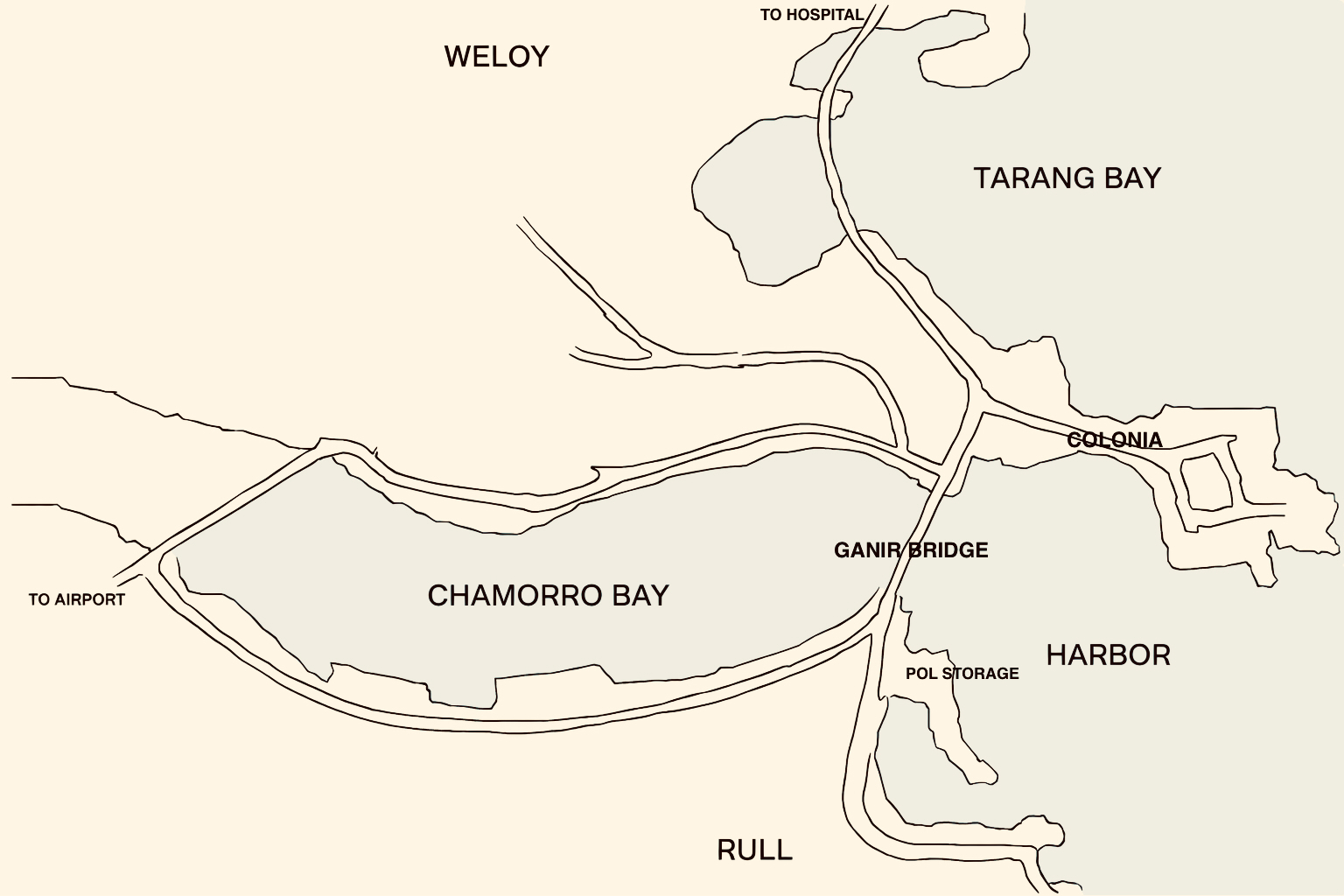
File:Ganir Bridge Location - 1.jpg
From Habele Institute
Size of this preview: 800 × 533 pixels. Other resolution: 1,536 × 1,024 pixels.
Original file (1,536 × 1,024 pixels, file size: 441 KB, MIME type: image/jpeg)
Simple map of area around Colonia, Yap indicating location of the Gainr Bridge, which connects Colonia to Rull
File history
Click on a date/time to view the file as it appeared at that time.
| Date/Time | Thumbnail | Dimensions | User | Comment | |
|---|---|---|---|---|---|
| current | 17:25, 16 December 2025 | | 1,536 × 1,024 (441 KB) | HIAdmin (talk | contribs) |
You cannot overwrite this file.
File usage
The following page uses this file: