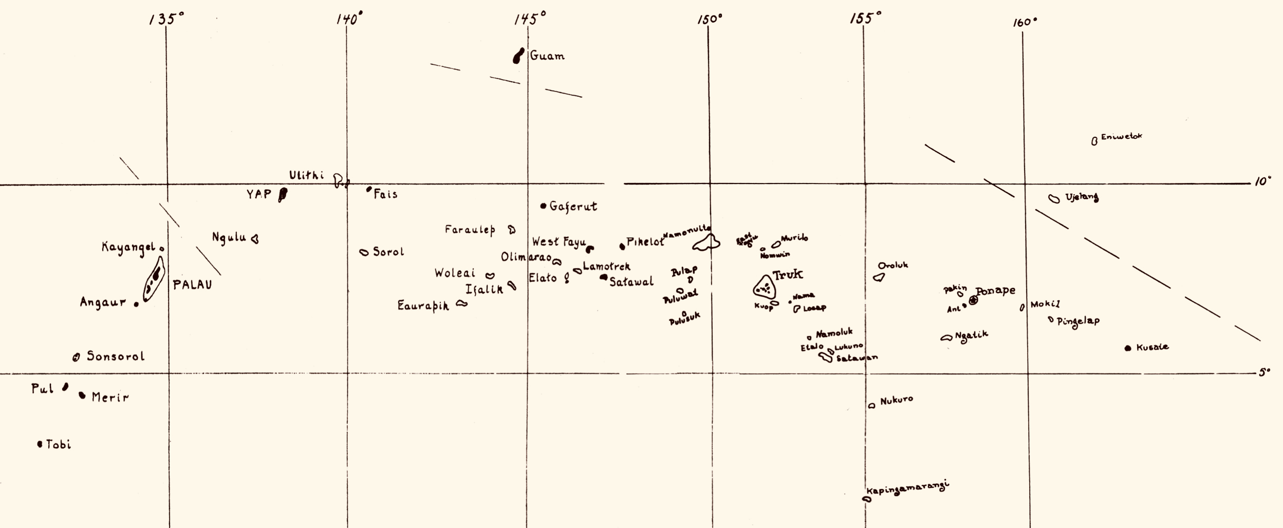
File:Caroline Islands Map - 1.jpg
From Habele Institute
Size of this preview: 800 × 329 pixels. Other resolution: 2,497 × 1,027 pixels.
Original file (2,497 × 1,027 pixels, file size: 440 KB, MIME type: image/jpeg)
Caroline Islands, or "Micronesia"
File history
Click on a date/time to view the file as it appeared at that time.
| Date/Time | Thumbnail | Dimensions | User | Comment | |
|---|---|---|---|---|---|
| current | 14:33, 12 January 2026 | 2,497 × 1,027 (440 KB) | HIAdmin (talk | contribs) |
You cannot overwrite this file.
File usage
The following page uses this file: