File:01 Cutout 1901 German Map.jpg
From Habele Institute

Size of this preview: 787 × 600 pixels. Other resolution: 895 × 682 pixels.
Original file (895 × 682 pixels, file size: 322 KB, MIME type: image/jpeg)
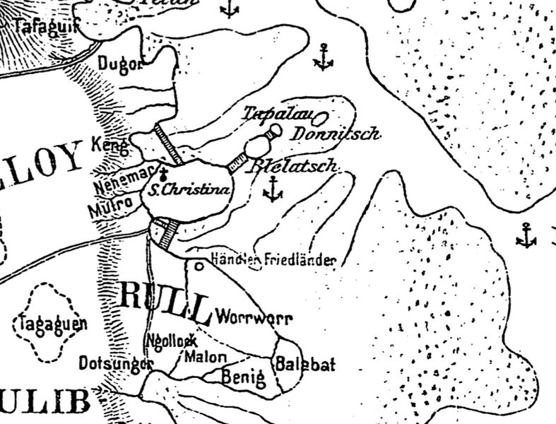
Selection from German Map, 1901, detailing German Period bridges, including bridge connecting Colonia to Rull.
File history
Click on a date/time to view the file as it appeared at that time.
| Date/Time | Thumbnail | Dimensions | User | Comment | |
|---|---|---|---|---|---|
| current | 19:47, 12 December 2025 | | 895 × 682 (322 KB) | HIAdmin (talk | contribs) |
You cannot overwrite this file.
File usage
The following page uses this file: